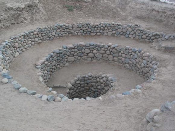
The mystery of the Nazca lines solved?
Water is life…

From Motherboard,
Satellite Images Revealed the Secret Meaning of These Ancient Desert Spirals
by Kaleigh Rogers
“The Nazca lines are world famous geoglyphs, and their nearby spiral structure help explain why they were built.
Imagine staring out the window of an airplane and seeing a 1,200-foot hummingbird carved into the earth. Now imagine realizing that design was carved sometime between 1 and 700 AD. That’s how the Nazca lines were first introduced to the western world.
Found in the southern desert region of Peru, the Nazca lines are massive drawings in the soil, also known as geoglyphs. They’re named after the ancient civilization that lived in the region: the Nazca. The lines range from spirals to intricate designs like monkeys, llamas, and flowers. Some of the drawings are up to 1,200 feet—that’s more than three football fields—which means they’re best viewed from above, in a plane, or from a satellite.
But they were created long before planes or satellites, leaving generations of scholars to ponder why they were made, particularly if the Nazca people couldn’t enjoy the full glory of their work. Thanks to satellite imaging, scientists believe they have a good hypothesis for the mystery behind these lines. They were linked to the most precious desert resource: water…”
For the rest. click here.
Share
